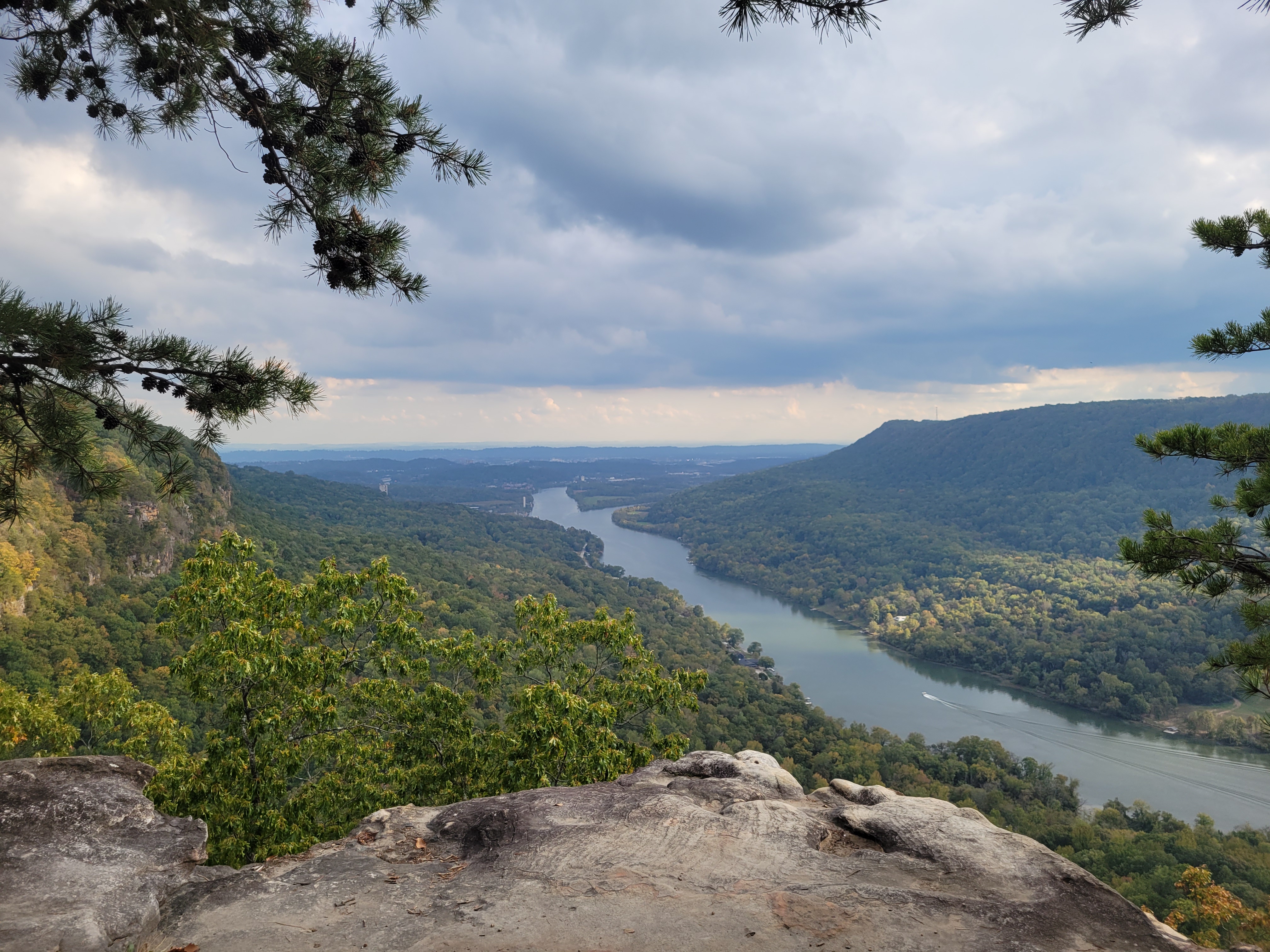
I drove about two hours to hike Edwards Point from Rainbow Lake, and the hike itself took about two hours. That makes the obvious question hard to avoid: is the overlook worth that kind of drive?
For me, mostly yes. The route has some annoyances: limited parking, a tucked-away trailhead in a residential part of Signal Mountain, a few confusing spots around Rainbow Lake, and an overlook that can feel crowded because there is not much room at the top. But the view over the Tennessee River Valley is strong enough that the hike still works, especially if you are already near Chattanooga or want a fall overlook hike with some variety.
Trail stats and getting there
My route from Rainbow Lake took about two hours of hiking, with a longer lake section on the way out and a shorter return past the dam and suspension bridge. Exact mileage depends on which lake option you take, so check your map before committing to the route. The trail gains a moderate amount of elevation overall, featuring some steep sections after the lake and a more plateau-like feel as you near the top. The hike is classified as moderate in difficulty, with a few stretches that will noticeably slow your pace. Parking is limited to the Rainbow Lake lot, which is small and tucked into a residential neighborhood on Signal Mountain.
The Rainbow Lake section: which way to go
How the hike begins: descent toward the lake
The trail opens with a gradual descent toward Rainbow Lake. The wooded approach down to the water is pleasant, especially in October when the fall color is building. The canopy has good variety, and the descent feels gradual enough to ease into the hike rather than throw you into hard climbing right away.
Left or right: the route decision at the lake
Near Rainbow Lake, the trail splits. Going left is the shorter option; it skirts the dam and crosses a suspension bridge over Middle Creek. Going right adds under a mile, loops fully around the lake, and takes you over a different suspension bridge. I went the longer lakeside loop on the way there and returned via the shorter dam route. Take the longer route if you want the fuller lake section. Take the shorter route if your main goal is the overlook.


Navigation note
The trail is not clearly marked in a few spots along the lake section. I briefly got turned around after the suspension bridge before correcting course, and this is worth knowing so it doesn’t throw you off when it happens. Slow down and look at the map if you feel like you’re going in the wrong direction.


The climb from the lake to the ridgeline
Steep in places, then it opens up
After the lake, the trail starts climbing, and some sections are steep enough to noticeably slow your pace. The terrain is rocky and rooted in places, which is typical for this part of the state. The reward for the climbing is that the trail gradually levels into something more plateau-like as you approach the upper section of Signal Mountain, and partial views through the treeline start appearing to hint at what’s ahead.

The final approach to Edwards Point
The last stretch before the overlook moves through wooded and brushy terrain, with glimpses of the Tennessee River Valley showing through the trees. After the navigation questions near Rainbow Lake, this section is more straightforward and easier to follow. The transition from brushy cover to open overlook is abrupt in the best possible way: there’s no long anticlimactic build, the view simply appears, and it’s very good. Light rain caught me on the return through this section, and the trail handled it without issue.
What the Tennessee River Gorge overlook actually delivers
The view at Edwards Point
The Edwards Point overlook gives a wide, open view over the Tennessee River Valley, with the gorge dropping sharply away beneath you and Chattanooga visible in the distance. It feels like a real overlook, not just a partial opening in the trees. When I arrived, several other hikers were already at the overlook taking photos, which gives you a realistic sense of the crowd dynamic on a good fall weekend.

Managing expectations at the overlook
The viewpoint is not large. It’s a natural rocky outcrop that can feel crowded on busy days, and you’ll be sharing it with a rotating group of hikers on weekends. That’s a minor thing, not a dealbreaker, but worth knowing if you’re expecting a quiet solo moment with the gorge.
Best time to visit and what to bring
When to hike the Edwards Point Trail
Mid-October is a strong window. The fall foliage on the descent toward Rainbow Lake and along the lakeside section is at its best, and the temperatures are manageable for a hike with real climbing involved. Spring is also solid. Summer is doable, but the brushy final approach to the overlook feels more exposed in heat, and Signal Mountain can be warm and humid in July and August. Weekday mornings give you the best chance at a quiet overlook experience; fall weekends draw a crowd, especially when the color is peaking.
What to pack for this hike
- Water: at least 1 to 2 liters given the two hours of hiking and climbing involved; more in summer
- Layers: weather on Signal Mountain shifts; I got lightly rained on during the return and regretted not bringing a layer
- Sturdy shoes: the terrain after Rainbow Lake is uneven and rocky in sections
- Change of clothes in the car: makes the drive home after a wet or muddy return considerably more comfortable
Final notes for the Edwards Point Trail
Edwards Point is worth doing if you want a strong overlook hike near Chattanooga, especially in fall. From Rainbow Lake, the route has some small annoyances: limited parking, some unclear spots around the lake, and a viewpoint that can feel crowded. But the payoff is real. If you take the longer lake option on the way out and return by the shorter route, the hike has enough variety to feel like more than just a walk to a viewpoint.
For the route itself: take the right-side option at Rainbow Lake if this is your first visit. The fuller lake experience and the suspension bridge make it the more rewarding choice, and the added distance is modest. Download a map before you leave home, slow down in the spots near the lake, and give yourself a buffer on arrival time if you’re coming on a weekend.
Leave a Reply